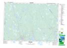
Maps showing Ryers Pond, Shelburne, Nova Scotia
Ryers Pond is a Lake located in Shelburne, Nova Scotia.
- Latitude: 43° 46' 20'' North (decimal: 43.7722222)
- Longitude: 65° 20' 21'' West (decimal: -65.3391666)
- Topography Feature Category: Lake
- Geographical Feature: Pond
- Canadian Province/Territory: Nova Scotia
- Location: Shelburne
- Atlas of Canada Locator Map: Ryers Pond
- GPS Coordinate Locator Map: Ryers Pond Lat/Long
Ryers Pond NTS Map Sheets