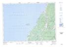
Maps showing St. Rose Pond, Inverness, Nova Scotia
St. Rose Pond is a Lake located in Inverness, Nova Scotia and has an elevation of 14 meters.
- Latitude: 46° 21' 24'' North (decimal: 46.3566666)
- Longitude: 61° 11' 8'' West (decimal: -61.1855555)
- Topography Feature Category: Lake
- Geographical Feature: Pond
- Canadian Province/Territory: Nova Scotia
- Elevation: 14 meters
- Location: Inverness
- Atlas of Canada Locator Map: St. Rose Pond
- GPS Coordinate Locator Map: St. Rose Pond Lat/Long