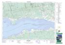
Maps showing Saints Rest, Colchester, Nova Scotia
Saints Rest is a Unincorporated area located in Colchester, Nova Scotia and has an elevation of 5 meters.
- Latitude: 45° 23' 51'' North (decimal: 45.3974999)
- Longitude: 63° 46' 59'' West (decimal: -63.7830555)
- Topography Feature Category: Unincorporated area
- Geographical Feature: Dispersed Rural Community
- Canadian Province/Territory: Nova Scotia
- Elevation: 5 meters
- Location: Colchester
- Atlas of Canada Locator Map: Saints Rest
- GPS Coordinate Locator Map: Saints Rest Lat/Long