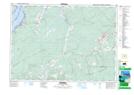
Maps showing Salt Springs Station, Cumberland, Nova Scotia
Salt Springs Station is a Unincorporated area located in Cumberland, Nova Scotia and has an elevation of 48 meters.
- Latitude: 45° 41' 4'' North (decimal: 45.6844444)
- Longitude: 64° 0' 25'' West (decimal: -64.0069444)
- Topography Feature Category: Unincorporated area
- Geographical Feature: Railway Point
- Canadian Province/Territory: Nova Scotia
- Elevation: 48 meters
- Location: Cumberland
- Atlas of Canada Locator Map: Salt Springs Station
- GPS Coordinate Locator Map: Salt Springs Station Lat/Long