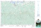
Maps showing Sand Point, Colchester, Nova Scotia
Sand Point is a Unincorporated area located in Colchester, Nova Scotia and has an elevation of 3 meters.
- Latitude: 45° 44' 29'' North (decimal: 45.7413888)
- Longitude: 63° 16' 48'' West (decimal: -63.2799998)
- Topography Feature Category: Unincorporated area
- Geographical Feature: Dispersed Rural Community
- Canadian Province/Territory: Nova Scotia
- Elevation: 3 meters
- Location: Colchester
- Atlas of Canada Locator Map: Sand Point
- GPS Coordinate Locator Map: Sand Point Lat/Long