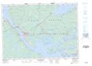
Maps showing Sand Point, Guysborough, Nova Scotia
Sand Point is a Unincorporated area located in Guysborough, Nova Scotia and has an elevation of 21 meters.
- Latitude: 45° 31' 7'' North (decimal: 45.5186111)
- Longitude: 61° 15' 41'' West (decimal: -61.2613888)
- Topography Feature Category: Unincorporated area
- Geographical Feature: Community
- Canadian Province/Territory: Nova Scotia
- Elevation: 21 meters
- Location: Guysborough
- Atlas of Canada Locator Map: Sand Point
- GPS Coordinate Locator Map: Sand Point Lat/Long
Sand Point NTS Map Sheets