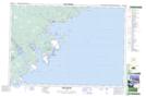
Maps showing Sandy Bay Landings, Queens, Nova Scotia
Sandy Bay Landings is a Unincorporated area located in Queens, Nova Scotia and has an elevation of 27 meters.
- Latitude: 43° 48' 49'' North (decimal: 43.8136111)
- Longitude: 64° 53' 43'' West (decimal: -64.8952777)
- Topography Feature Category: Unincorporated area
- Geographical Feature: Landing
- Canadian Province/Territory: Nova Scotia
- Elevation: 27 meters
- Location: Queens
- Atlas of Canada Locator Map: Sandy Bay Landings
- GPS Coordinate Locator Map: Sandy Bay Landings Lat/Long
Sandy Bay Landings NTS Map Sheets