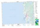
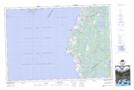
Maps showing Sandyland Ponds, Yarmouth; Digby, Nova Scotia
Sandyland Ponds is a Lake located in Yarmouth; Digby, Nova Scotia and has an elevation of 1 meters.
- Latitude: 43° 59' 40'' North (decimal: 43.9944444)
- Longitude: 66° 9' 5'' West (decimal: -66.1513888)
- Topography Feature Category: Lake
- Geographical Feature: Ponds
- Canadian Province/Territory: Nova Scotia
- Elevation: 1 meters
- Location: Yarmouth; Digby
- Atlas of Canada Locator Map: Sandyland Ponds
- GPS Coordinate Locator Map: Sandyland Ponds Lat/Long
Sandyland Ponds NTS Map Sheets

020O Map Not Available Topographic Map at 1:250,000 scale
