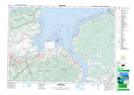
Maps showing Scots Bay Road, Kings, Nova Scotia
Scots Bay Road is a Unincorporated area located in Kings, Nova Scotia and has an elevation of 167 meters.
- Latitude: 45° 13' 38'' North (decimal: 45.2272222)
- Longitude: 64° 23' 55'' West (decimal: -64.3986111)
- Topography Feature Category: Unincorporated area
- Geographical Feature: Dispersed Rural Community
- Canadian Province/Territory: Nova Scotia
- Elevation: 167 meters
- Location: Kings
- Atlas of Canada Locator Map: Scots Bay Road
- GPS Coordinate Locator Map: Scots Bay Road Lat/Long