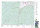
Maps showing Smiths Corner, Hants, Nova Scotia
Smiths Corner is a Unincorporated area located in Hants, Nova Scotia and has an elevation of 118 meters.
- Latitude: 44° 50' 50'' North (decimal: 44.8472222)
- Longitude: 64° 13' 25'' West (decimal: -64.2236111)
- Topography Feature Category: Unincorporated area
- Geographical Feature: Locality
- Canadian Province/Territory: Nova Scotia
- Elevation: 118 meters
- Location: Hants
- Atlas of Canada Locator Map: Smiths Corner
- GPS Coordinate Locator Map: Smiths Corner Lat/Long
Smiths Corner NTS Map Sheets