Canada Topographic Maps

South Stewiacke River Topo Maps

Topography maps and Latitude/Longitude Location

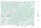
Maps showing South Stewiacke River, Nova Scotia

South Stewiacke River is a River located in Nova Scotia.

  • Latitude: 45° 13' North   (decimal: 45.2166666)
  • Longitude: 63° 1' West   (decimal: -63.0158333)
  • Topography Feature Category: River
  • Geographical Feature: River
  • Canadian Province/Territory: Nova Scotia
  • GPS Coordinate Locator Map: South Stewiacke River Lat/Long

South Stewiacke River NTS Map Sheets

011E03 Shubenacadie Topographic Map at 1:50,000 scale

011E Truro Topographic Map at 1:250,000 scale

 
Buy Topographic Maps DVD
Newsletter Sign-up

Yes, I want to receive map store discounts.


Bookmark and Share