Maps showing Stage Ponds, Lunenburg, Nova Scotia
Stage Ponds is a Lake located in Lunenburg, Nova Scotia and has an elevation of 6 meters.
- Latitude: 44° 12' 23'' North (decimal: 44.2063888)
- Longitude: 64° 26' 30'' West (decimal: -64.4416666)
- Topography Feature Category: Lake
- Geographical Feature: Ponds
- Canadian Province/Territory: Nova Scotia
- Elevation: 6 meters
- Location: Lunenburg
- Atlas of Canada Locator Map: Stage Ponds
- GPS Coordinate Locator Map: Stage Ponds Lat/Long
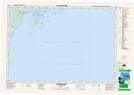
Stage Ponds NTS Map Sheets