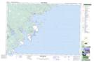
Maps showing St. Catherines River, Queens, Nova Scotia
St. Catherines River is a Unincorporated area located in Queens, Nova Scotia and has an elevation of 4 meters.
- Latitude: 43° 50' 30'' North (decimal: 43.8416999)
- Longitude: 64° 51' 25'' West (decimal: -64.8568999)
- Topography Feature Category: Unincorporated area
- Geographical Feature: Locality
- Canadian Province/Territory: Nova Scotia
- Elevation: 4 meters
- Location: Queens
- Atlas of Canada Locator Map: St. Catherines River
- GPS Coordinate Locator Map: St. Catherines River Lat/Long
St. Catherines River NTS Map Sheets