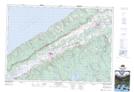
Maps showing St. Croix Cove, Annapolis, Nova Scotia
St. Croix Cove is a Unincorporated area located in Annapolis, Nova Scotia and has an elevation of 81 meters.
- Latitude: 44° 55' 22'' North (decimal: 44.9227777)
- Longitude: 65° 17' 47'' West (decimal: -65.2963888)
- Topography Feature Category: Unincorporated area
- Geographical Feature: Dispersed Rural Community
- Canadian Province/Territory: Nova Scotia
- Elevation: 81 meters
- Location: Annapolis
- Atlas of Canada Locator Map: St. Croix Cove
- GPS Coordinate Locator Map: St. Croix Cove Lat/Long
St. Croix Cove NTS Map Sheets