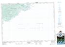
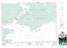
Maps showing St. Esprit Lake, Richmond, Nova Scotia
St. Esprit Lake is a Lake located in Richmond, Nova Scotia and has an elevation of 0 meters.
- Latitude: 45° 38' 48'' North (decimal: 45.6466666)
- Longitude: 60° 29' 33'' West (decimal: -60.4924999)
- Topography Feature Category: Lake
- Geographical Feature: Lake
- Canadian Province/Territory: Nova Scotia
- Elevation: 0 meters
- Location: Richmond
- Atlas of Canada Locator Map: St. Esprit Lake
- GPS Coordinate Locator Map: St. Esprit Lake Lat/Long
St. Esprit Lake NTS Map Sheets