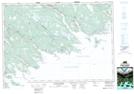
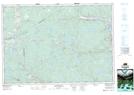
Maps showing Stewart Lake, Guysborough, Nova Scotia
Stewart Lake is a Lake located in Guysborough, Nova Scotia and has an elevation of 57 meters.
- Latitude: 45° 14' 54'' North (decimal: 45.2483333)
- Longitude: 61° 43' 18'' West (decimal: -61.7216666)
- Topography Feature Category: Lake
- Geographical Feature: Lake
- Canadian Province/Territory: Nova Scotia
- Elevation: 57 meters
- Location: Guysborough
- Atlas of Canada Locator Map: Stewart Lake
- GPS Coordinate Locator Map: Stewart Lake Lat/Long
Stewart Lake NTS Map Sheets