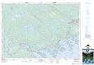
Maps showing Tangier, Halifax, Nova Scotia
Tangier is a Unincorporated area located in Halifax, Nova Scotia and has an elevation of 15 meters.
- Latitude: 44° 48' 18'' North (decimal: 44.8050000)
- Longitude: 62° 41' 38'' West (decimal: -62.6938888)
- Topography Feature Category: Unincorporated area
- Geographical Feature: Dispersed Rural Community
- Canadian Province/Territory: Nova Scotia
- Elevation: 15 meters
- Location: Halifax
- Atlas of Canada Locator Map: Tangier
- GPS Coordinate Locator Map: Tangier Lat/Long