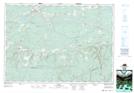
Maps showing Trout Pond, Cumberland, Nova Scotia
Trout Pond is a Lake located in Cumberland, Nova Scotia and has an elevation of 266 meters.
- Latitude: 45° 35' 25'' North (decimal: 45.5902777)
- Longitude: 63° 30' 53'' West (decimal: -63.5147222)
- Topography Feature Category: Lake
- Geographical Feature: Pond
- Canadian Province/Territory: Nova Scotia
- Elevation: 266 meters
- Location: Cumberland
- Atlas of Canada Locator Map: Trout Pond
- GPS Coordinate Locator Map: Trout Pond Lat/Long