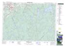
Maps showing Upper Fishing Pool, Annapolis, Nova Scotia
Upper Fishing Pool is a River feature located in Annapolis, Nova Scotia.
- Latitude: 44° 49' North (decimal: 44.8166666)
- Longitude: 64° 56' West (decimal: -64.9324999)
- Topography Feature Category: River feature
- Geographical Feature: Pool
- Canadian Province/Territory: Nova Scotia
- Location: Annapolis
- Atlas of Canada Locator Map: Upper Fishing Pool
- GPS Coordinate Locator Map: Upper Fishing Pool Lat/Long
Upper Fishing Pool NTS Map Sheets