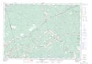
Maps showing Upper Nine Mile River, Hants, Nova Scotia
Upper Nine Mile River is a Unincorporated area located in Hants, Nova Scotia and has an elevation of 52 meters.
- Latitude: 45° 4' 45'' North (decimal: 45.0791666)
- Longitude: 63° 37' 35'' West (decimal: -63.6263888)
- Topography Feature Category: Unincorporated area
- Geographical Feature: Community
- Canadian Province/Territory: Nova Scotia
- Elevation: 52 meters
- Location: Hants
- Atlas of Canada Locator Map: Upper Nine Mile River
- GPS Coordinate Locator Map: Upper Nine Mile River Lat/Long