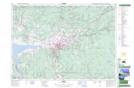
Maps showing Upper Pleasant Valley, Colchester, Nova Scotia
Upper Pleasant Valley is a Unincorporated area located in Colchester, Nova Scotia.
- Latitude: 45° 15' North (decimal: 45.2499999)
- Longitude: 63° 20' West (decimal: -63.3325000)
- Topography Feature Category: Unincorporated area
- Geographical Feature: Locality
- Canadian Province/Territory: Nova Scotia
- Location: Colchester
- GPS Coordinate Locator Map: Upper Pleasant Valley Lat/Long