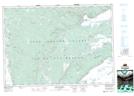
Maps showing Upper Southwest Mabou, Inverness, Nova Scotia
Upper Southwest Mabou is a Unincorporated area located in Inverness, Nova Scotia and has an elevation of 104 meters.
- Latitude: 45° 57' 14'' North (decimal: 45.9538888)
- Longitude: 61° 21' 40'' West (decimal: -61.3611111)
- Topography Feature Category: Unincorporated area
- Geographical Feature: Community
- Canadian Province/Territory: Nova Scotia
- Elevation: 104 meters
- Location: Inverness
- Atlas of Canada Locator Map: Upper Southwest Mabou
- GPS Coordinate Locator Map: Upper Southwest Mabou Lat/Long