Maps showing Valley Mills, Inverness, Nova Scotia
Valley Mills is a Unincorporated area located in Inverness, Nova Scotia and has an elevation of 43 meters.
- Latitude: 45° 50' 38'' North (decimal: 45.8438888)
- Longitude: 61° 6' 38'' West (decimal: -61.1105555)
- Topography Feature Category: Unincorporated area
- Geographical Feature: Community
- Canadian Province/Territory: Nova Scotia
- Elevation: 43 meters
- Location: Inverness
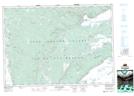
- Atlas of Canada Locator Map: Valley Mills
- GPS Coordinate Locator Map: Valley Mills Lat/Long