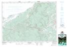
Maps showing Vincents Lake, Antigonish, Nova Scotia
Vincents Lake is a Lake located in Antigonish, Nova Scotia and has an elevation of 272 meters.
- Latitude: 45° 42' 41'' North (decimal: 45.7113888)
- Longitude: 62° 9' 19'' West (decimal: -62.1552777)
- Topography Feature Category: Lake
- Geographical Feature: Lake
- Canadian Province/Territory: Nova Scotia
- Elevation: 272 meters
- Location: Antigonish
- Atlas of Canada Locator Map: Vincents Lake
- GPS Coordinate Locator Map: Vincents Lake Lat/Long