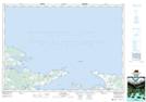
Maps showing Wallace Ridge, Cumberland, Nova Scotia
Wallace Ridge is a Unincorporated area located in Cumberland, Nova Scotia and has an elevation of 42 meters.
- Latitude: 45° 47' 3'' North (decimal: 45.7841666)
- Longitude: 63° 24' 47'' West (decimal: -63.4130555)
- Topography Feature Category: Unincorporated area
- Geographical Feature: Community
- Canadian Province/Territory: Nova Scotia
- Elevation: 42 meters
- Location: Cumberland
- Atlas of Canada Locator Map: Wallace Ridge
- GPS Coordinate Locator Map: Wallace Ridge Lat/Long