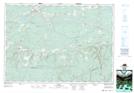
Maps showing Wentworth Valley, Cumberland, Nova Scotia
Wentworth Valley is a Unincorporated area located in Cumberland, Nova Scotia and has an elevation of 95 meters.
- Latitude: 45° 36' 42'' North (decimal: 45.6116666)
- Longitude: 63° 33' 41'' West (decimal: -63.5613888)
- Topography Feature Category: Unincorporated area
- Geographical Feature: Locality
- Canadian Province/Territory: Nova Scotia
- Elevation: 95 meters
- Location: Cumberland
- Atlas of Canada Locator Map: Wentworth Valley
- GPS Coordinate Locator Map: Wentworth Valley Lat/Long