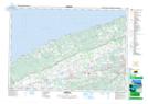
Maps showing West Glenmont, Kings, Nova Scotia
West Glenmont is a Unincorporated area located in Kings, Nova Scotia and has an elevation of 172 meters.
- Latitude: 45° 11' 19'' North (decimal: 45.1886111)
- Longitude: 64° 31' 15'' West (decimal: -64.5208333)
- Topography Feature Category: Unincorporated area
- Geographical Feature: Dispersed Rural Community
- Canadian Province/Territory: Nova Scotia
- Elevation: 172 meters
- Location: Kings
- Atlas of Canada Locator Map: West Glenmont
- GPS Coordinate Locator Map: West Glenmont Lat/Long