Maps showing Weston, Kings, Nova Scotia
Weston is a Unincorporated area located in Kings, Nova Scotia and has an elevation of 46 meters.
- Latitude: 45° 3' 29'' North (decimal: 45.0580555)
- Longitude: 64° 47' 32'' West (decimal: -64.7922222)
- Topography Feature Category: Unincorporated area
- Geographical Feature: Dispersed Rural Community
- Canadian Province/Territory: Nova Scotia
- Elevation: 46 meters
- Location: Kings
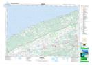
- Atlas of Canada Locator Map: Weston
- GPS Coordinate Locator Map: Weston Lat/Long