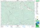
Maps showing West River Station, Pictou, Nova Scotia
West River Station is a Unincorporated area located in Pictou, Nova Scotia and has an elevation of 144 meters.
- Latitude: 45° 26' 53'' North (decimal: 45.4480555)
- Longitude: 62° 54' 32'' West (decimal: -62.9088888)
- Topography Feature Category: Unincorporated area
- Geographical Feature: Community
- Canadian Province/Territory: Nova Scotia
- Elevation: 144 meters
- Location: Pictou
- Atlas of Canada Locator Map: West River Station
- GPS Coordinate Locator Map: West River Station Lat/Long