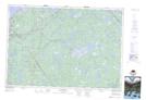
Maps showing Weymouth Mills, Digby, Nova Scotia
Weymouth Mills is a Unincorporated area located in Digby, Nova Scotia and has an elevation of 43 meters.
- Latitude: 44° 24' 41'' North (decimal: 44.4113888)
- Longitude: 65° 57' 16'' West (decimal: -65.9544444)
- Topography Feature Category: Unincorporated area
- Geographical Feature: Community
- Canadian Province/Territory: Nova Scotia
- Elevation: 43 meters
- Location: Digby
- Atlas of Canada Locator Map: Weymouth Mills
- GPS Coordinate Locator Map: Weymouth Mills Lat/Long
Weymouth Mills NTS Map Sheets