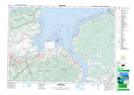
Maps showing White Rock Pond, Kings, Nova Scotia
White Rock Pond is a Lake located in Kings, Nova Scotia and has an elevation of 78 meters.
- Latitude: 45° 3' 8'' North (decimal: 45.0522222)
- Longitude: 64° 24' 23'' West (decimal: -64.4063888)
- Topography Feature Category: Lake
- Geographical Feature: Pond
- Canadian Province/Territory: Nova Scotia
- Elevation: 78 meters
- Location: Kings
- Atlas of Canada Locator Map: White Rock Pond
- GPS Coordinate Locator Map: White Rock Pond Lat/Long