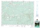
Maps showing Zollers Pond, Cumberland, Nova Scotia
Zollers Pond is a Lake located in Cumberland, Nova Scotia and has an elevation of 42 meters.
- Latitude: 45° 41' 47'' North (decimal: 45.6963888)
- Longitude: 63° 59' 7'' West (decimal: -63.9852777)
- Topography Feature Category: Lake
- Geographical Feature: Pond
- Canadian Province/Territory: Nova Scotia
- Elevation: 42 meters
- Location: Cumberland
- Atlas of Canada Locator Map: Zollers Pond
- GPS Coordinate Locator Map: Zollers Pond Lat/Long