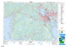
Maps showing The Rocking Stone, Halifax, Nova Scotia
The Rocking Stone is a Shoal located in Halifax, Nova Scotia and has an elevation of 90 meters.
- Latitude: 44° 36' North (decimal: 44.5999999)
- Longitude: 63° 37' West (decimal: -63.6158333)
- Topography Feature Category: Shoal
- Geographical Feature: Rock
- Canadian Province/Territory: Nova Scotia
- Elevation: 90 meters
- Location: Halifax
- Atlas of Canada Locator Map: The Rocking Stone
- GPS Coordinate Locator Map: The Rocking Stone Lat/Long