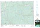
Maps showing Gillis Lake, Antigonish, Nova Scotia
Gillis Lake is a Lake located in Antigonish, Nova Scotia and has an elevation of 135 meters.
- Latitude: 45° 28' 50'' North (decimal: 45.4805555)
- Longitude: 61° 57' 52'' West (decimal: -61.9644444)
- Topography Feature Category: Lake
- Geographical Feature: Lake
- Canadian Province/Territory: Nova Scotia
- Elevation: 135 meters
- Location: Antigonish
- Atlas of Canada Locator Map: Gillis Lake
- GPS Coordinate Locator Map: Gillis Lake Lat/Long