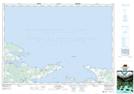
Maps showing Seal Creek, Pictou, Nova Scotia
Seal Creek is a River located in Pictou, Nova Scotia.
- Latitude: 45° 45' North (decimal: 45.7499999)
- Longitude: 63° 8' West (decimal: -63.1324999)
- Topography Feature Category: River
- Geographical Feature: Creek
- Canadian Province/Territory: Nova Scotia
- Location: Pictou
- Atlas of Canada Locator Map: Seal Creek
- GPS Coordinate Locator Map: Seal Creek Lat/Long