Canada Topographic Maps

Humtagut Creek Topo Maps

Topography maps and Latitude/Longitude Location

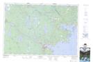
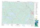
Maps showing Humtagut Creek, Nova Scotia

Humtagut Creek is a River located in Nova Scotia.

  • Latitude: 44° 11' North   (decimal: 44.1833333)
  • Longitude: 64° 40' West   (decimal: -64.6658333)
  • Topography Feature Category: River
  • Geographical Feature: Creek
  • Canadian Province/Territory: Nova Scotia
  • GPS Coordinate Locator Map: Humtagut Creek Lat/Long

Humtagut Creek NTS Map Sheets

021A02 Liverpool Topographic Map at 1:50,000 scale

021A07 Bridgewater Topographic Map at 1:50,000 scale

021A Annapolis Royal Topographic Map at 1:250,000 scale

 
Buy Topographic Maps DVD
Newsletter Sign-up

Yes, I want to receive map store discounts.


Bookmark and Share