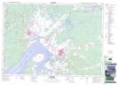
Maps showing Champ de tir Amherst, Cumberland, Nova Scotia
Champ de tir Amherst is a Military area located in Cumberland, Nova Scotia.
- Latitude: 45° 49' 14'' North (decimal: 45.8205555)
- Longitude: 64° 10' 13'' West (decimal: -64.1702777)
- Topography Feature Category: Military area
- Geographical Feature: C.M.F.C.
- Canadian Province/Territory: Nova Scotia
- Location: Cumberland
- Atlas of Canada Locator Map: Champ de tir Amherst
- GPS Coordinate Locator Map: Champ de tir Amherst Lat/Long