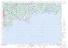
Maps showing Osborne Head Range, Halifax, Nova Scotia
Osborne Head Range is a Military area located in Halifax, Nova Scotia.
- Latitude: 44° 36' 46'' North (decimal: 44.6127777)
- Longitude: 63° 25' 23'' West (decimal: -63.4230555)
- Topography Feature Category: Military area
- Geographical Feature: C.F.T.A.
- Canadian Province/Territory: Nova Scotia
- Location: Halifax
- Atlas of Canada Locator Map: Osborne Head Range
- GPS Coordinate Locator Map: Osborne Head Range Lat/Long
Osborne Head Range NTS Map Sheets