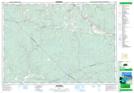
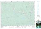
Maps showing Sunny Brae, Pictou, Nova Scotia
Sunny Brae is a Unincorporated area located in Pictou, Nova Scotia and has an elevation of 110 meters.
- Latitude: 45° 24' 12'' North (decimal: 45.4033333)
- Longitude: 62° 30' 22'' West (decimal: -62.5061111)
- Topography Feature Category: Unincorporated area
- Geographical Feature: Community
- Canadian Province/Territory: Nova Scotia
- Elevation: 110 meters
- Location: Pictou
- Atlas of Canada Locator Map: Sunny Brae
- GPS Coordinate Locator Map: Sunny Brae Lat/Long
Sunny Brae NTS Map Sheets