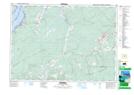
Maps showing River Hebert East (Strathcona), Nova Scotia
River Hebert East (Strathcona) is a Unincorporated area located in Nova Scotia and has an elevation of 30 meters.
- Latitude: 45° 41' 55'' North (decimal: 45.6986111)
- Longitude: 64° 21' 39'' West (decimal: -64.3608333)
- Topography Feature Category: Unincorporated area
- Geographical Feature: Dispersed Rural Community
- Canadian Province/Territory: Nova Scotia
- Elevation: 30 meters
- Atlas of Canada Locator Map: River Hebert East (Strathcona)
- GPS Coordinate Locator Map: River Hebert East (Strathcona) Lat/Long