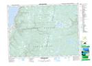
Maps showing McMillan Flowage, Victoria, Nova Scotia
McMillan Flowage is a Lake located in Victoria, Nova Scotia and has an elevation of 389 meters.
- Latitude: 46° 31' 14'' North (decimal: 46.5205555)
- Longitude: 60° 39' 2'' West (decimal: -60.6505555)
- Topography Feature Category: Lake
- Geographical Feature: Flowage
- Canadian Province/Territory: Nova Scotia
- Elevation: 389 meters
- Location: Victoria
- Atlas of Canada Locator Map: McMillan Flowage
- GPS Coordinate Locator Map: McMillan Flowage Lat/Long
McMillan Flowage NTS Map Sheets