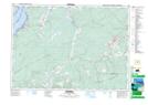
Maps showing Lower River Hebert, Cumberland, Nova Scotia
Lower River Hebert is a Unincorporated area located in Cumberland, Nova Scotia.
- Latitude: 45° 43' 17'' North (decimal: 45.7213999)
- Longitude: 64° 21' 20'' West (decimal: -64.3556000)
- Topography Feature Category: Unincorporated area
- Geographical Feature: Community
- Canadian Province/Territory: Nova Scotia
- Location: Cumberland
- Atlas of Canada Locator Map: Lower River Hebert
- GPS Coordinate Locator Map: Lower River Hebert Lat/Long