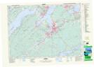
Maps showing Caribou Marsh 29, Cape Breton, Nova Scotia
Caribou Marsh 29 is a Indian Reserve located in Cape Breton, Nova Scotia.
- Latitude: 46° 3' 14'' North (decimal: 46.0538888)
- Longitude: 60° 13' 10'' West (decimal: -60.2194444)
- Topography Feature Category: Indian Reserve
- Geographical Feature: Indian Reserve - Réserve indienne
- Canadian Province/Territory: Nova Scotia
- Location: Cape Breton
- Atlas of Canada Locator Map: Caribou Marsh 29
- GPS Coordinate Locator Map: Caribou Marsh 29 Lat/Long