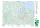
Maps showing Fisher's Grant 24, Pictou, Nova Scotia
Fisher's Grant 24 is a Indian Reserve located in Pictou, Nova Scotia.
- Latitude: 45° 40' 15'' North (decimal: 45.670833)
- Longitude: 62° 39' 10'' West (decimal: -62.6527778)
- Topography Feature Category: Indian Reserve
- Geographical Feature: Indian Reserve - Réserve indienne
- Canadian Province/Territory: Nova Scotia
- Location: Pictou
- Atlas of Canada Locator Map: Fisher's Grant 24
- GPS Coordinate Locator Map: Fisher's Grant 24 Lat/Long