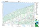
Maps showing Refuge d'oiseaux de Kentville, Nova Scotia
Refuge d'oiseaux de Kentville is a Conservation area located in Nova Scotia.
- Latitude: 45° 5' North (decimal: 45.0833333)
- Longitude: 64° 32' West (decimal: -64.5333333)
- Topography Feature Category: Conservation area
- Geographical Feature: Refuge d'oiseaux migrateurs
- Canadian Province/Territory: Nova Scotia
- Atlas of Canada Locator Map: Refuge d'oiseaux de Kentville
- GPS Coordinate Locator Map: Refuge d'oiseaux de Kentville Lat/Long