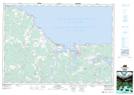
Maps showing Amherst Shore Provincial Park, Nova Scotia
Amherst Shore Provincial Park is a Conservation area located in Nova Scotia.
- Latitude: 45° 57' 0'' North (decimal: 45.95)
- Longitude: 63° 54' 47'' West (decimal: -63.9130555)
- Topography Feature Category: Conservation area
- Geographical Feature: Provincial Park
- Canadian Province/Territory: Nova Scotia
- Atlas of Canada Locator Map: Amherst Shore Provincial Park
- GPS Coordinate Locator Map: Amherst Shore Provincial Park Lat/Long