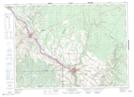
Maps showing Saint-Léonard Provincial Park, Madawaska, New Brunswick
Saint-Léonard Provincial Park is a Conservation area located in Madawaska, New Brunswick and has an elevation of 203 meters.
- Latitude: 47° 10' 34'' North (decimal: 47.1760863)
- Longitude: 67° 52' 34'' West (decimal: -67.8760288)
- Topography Feature Category: Conservation area
- Geographical Feature: Provincial Park
- Canadian Province/Territory: New Brunswick
- Elevation: 203 meters
- Location: Madawaska
- Atlas of Canada Locator Map: Saint-Léonard Provincial Park
- GPS Coordinate Locator Map: Saint-Léonard Provincial Park Lat/Long
Saint-Léonard Provincial Park NTS Map Sheets