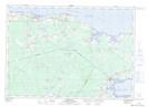
Maps showing Amos Creek, Westmorland, New Brunswick
Amos Creek is a Bay located in Westmorland, New Brunswick and has an elevation of 7 meters.
- Latitude: 46° 9' 16'' North (decimal: 46.1544509)
- Longitude: 64° 3' 14'' West (decimal: -64.0538044)
- Topography Feature Category: Bay
- Geographical Feature: Creek
- Canadian Province/Territory: New Brunswick
- Elevation: 7 meters
- Location: Westmorland
- Atlas of Canada Locator Map: Amos Creek
- GPS Coordinate Locator Map: Amos Creek Lat/Long