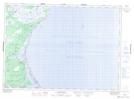
Maps showing Eel River Plain, Kent, New Brunswick
Eel River Plain is a Low vegetation located in Kent, New Brunswick.
- Latitude: 46° 59' North (decimal: 46.9832999)
- Longitude: 64° 57' West (decimal: -64.9499999)
- Topography Feature Category: Low vegetation
- Geographical Feature: Plain
- Canadian Province/Territory: New Brunswick
- Location: Kent
- GPS Coordinate Locator Map: Eel River Plain Lat/Long
Eel River Plain NTS Map Sheets