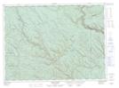
Maps showing Ferguson-Berry Gulch, New Brunswick
Ferguson-Berry Gulch is a Valley located in New Brunswick.
- Latitude: 47° 53' North (decimal: 47.8833000)
- Longitude: 67° 55' West (decimal: -67.9167000)
- Topography Feature Category: Valley
- Geographical Feature: Gulch
- Canadian Province/Territory: New Brunswick
- GPS Coordinate Locator Map: Ferguson-Berry Gulch Lat/Long
Ferguson-Berry Gulch NTS Map Sheets